
GPRS Locates Utilities On 60+ Acre Lot For Environmental Testing
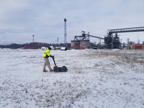
Ground Penetrating Radar Systems Ohio (GPRS Ohio) was recently called out to a project by an environmental company to locate utilities for a project on a 60+ acre lot inside of an active coal mine. The scope of the project was to locate any and all underground utilities for almost 50 soil boring sample locations to be drilled down 25+ feet. By using GPR and Radio Detection, GPRS was able to safely clear each specific location of any obstructions or impediments in the ground that could become dangerous while drilling. GPRS painted all utilities on site with spray paint and included depths of the lines found underground as well. GPR and Radio Detection is an accurate and effective way of locating underground utilities, vaults, tunnels, and other obstructions prior to any ground excavation. This project was a vital first step for the environmental company to ensure the safety of all employees, and also helped establish a clearer timeline that avoids stoppages due to utility strike incidents. The scheduling of the project went extremely smooth for all sides, and was performed by one technician for simplicity and best communication practice as well. Why would you risk digging underground without knowing where any utilities are in your designated area when GPRS has the ability locate and mark all utilities with depth indications for your safety!
The images to the side show some of the processes that lead to utilities being located on site.
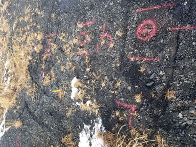
Below is a second photo displaying a utility line running next to a potential dig site.
For more information on how GPRS, Inc. can help you on your next project, please contact Colin Broughton at 216-379-4660 or by email at colin.broughton@gprsinc.com. We also have the capabilities of locating conduits, rebar, and post tension cables in a concrete slab.