Ground Penetrating Radar Systems of Ohio
Ground Penetrating Radar Services (GPR)

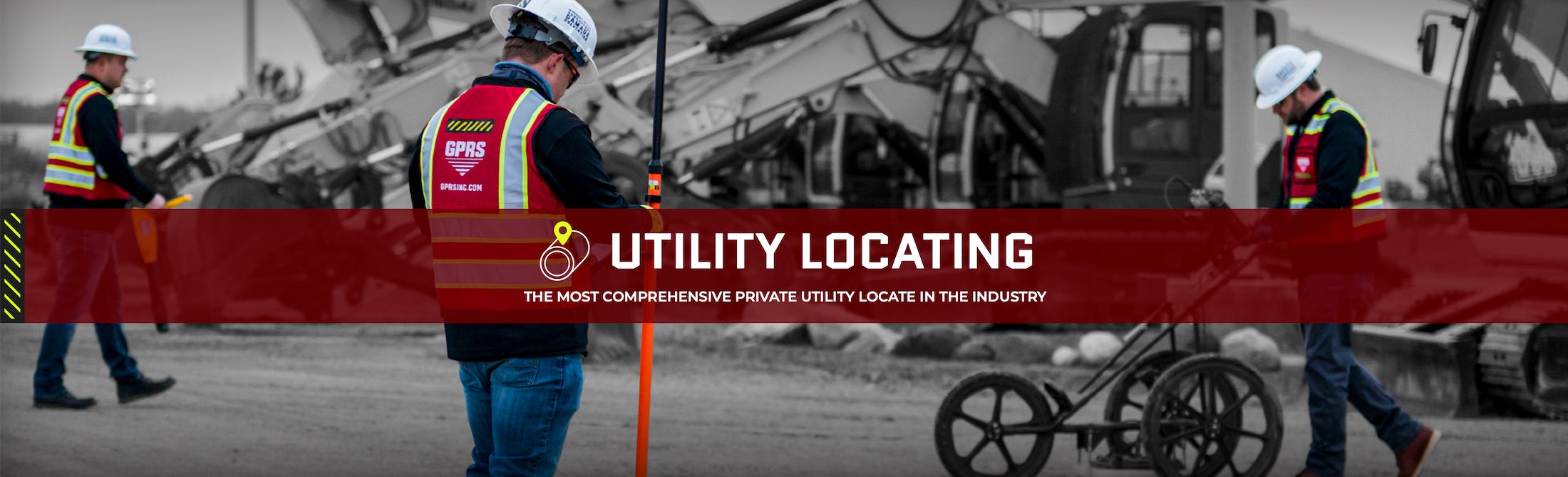
Utility Locating
Private utility locating is vital to any construction, excavation, or renovation project. 811 One Call services locate public utility lines, but do not provide depths for them. Nor do they detect or locate private utilities. Our private utility locating services employ Ground Penetrating Radar (GPR), Electromagnetic locators, CCTV Video Cameras, Acoustic leak locators and other equipment to scan for subsurface utilities, including depths and GPS mapping, saving time, money, and even lives by avoiding utility strikes to protect & all site employees and contractors from potential line strike damages. GPRS provides complimentary .KMZ files for all of our exterior utility locating projects.
 Ohio")
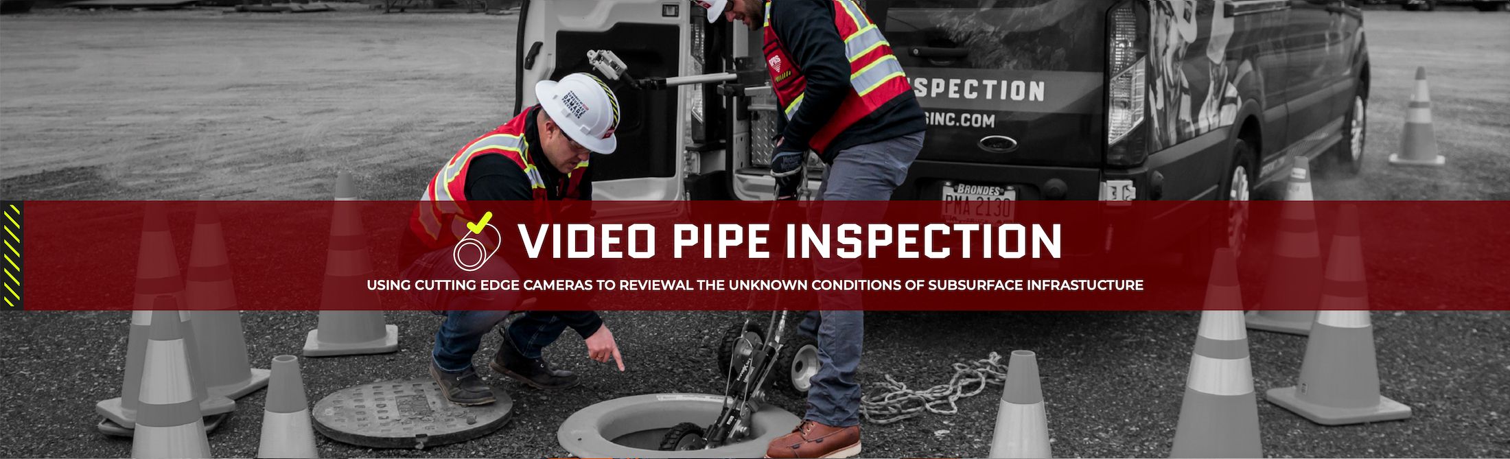
VIDEO PIPE INSPECTION (CCTV)
The majority of pipe defects occur underground in buried pipe that can only be accessed by excavation or CCTV cameras via a Video Pipe Inspection (VPI). GPRS deploys both robotic crawler CCTV cameras and lateral launch cameras and push cameras to document and assess water systems, drains, and conduct sewer inspections without costly excavation. Our NASSCO certified WinCan VPI reports provide clients the exact location, photo, video, and map of each defect, cross-referenced and tagged with a defect severity level. This allows our clients to visualize every inch of water and sewer pipe with in their system and to create comprehensive repair and maintenance plans to repair pipe damage in the most cost-effective manner possible.

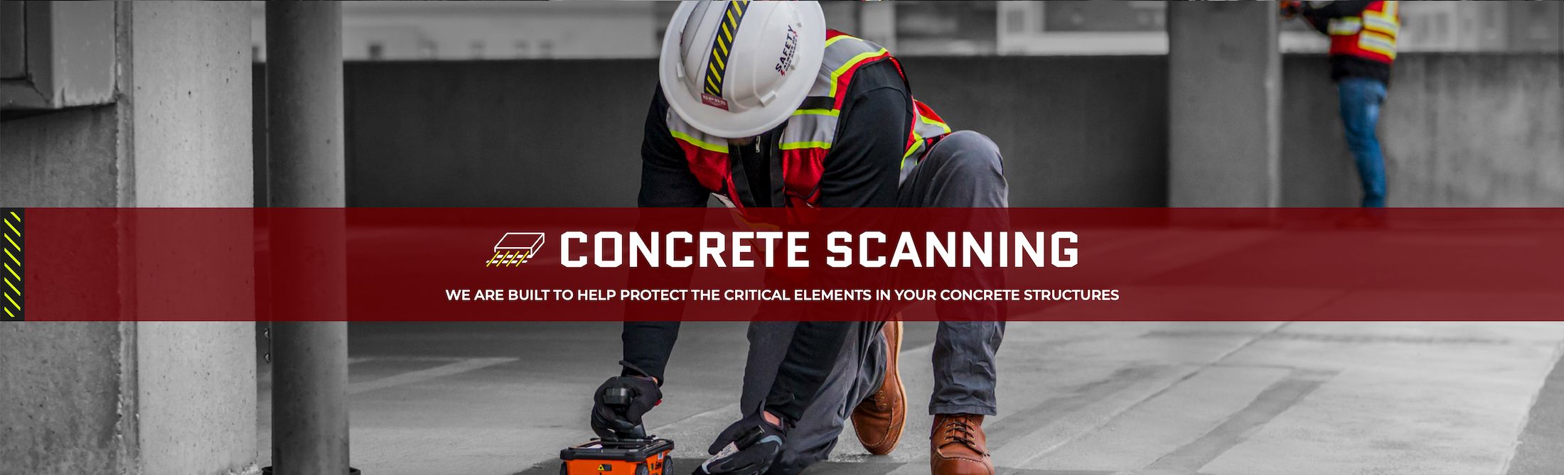
Concrete Scanning
Any project involving post-tension or slab-on-grade concrete contains an inherent risk of costly damage and/or injury when you core or cut into the slab. Rebar, conduit, and post-tension cables pose significant strike risks, and each has its own unique GPR imaging signature. GPRS’ concrete scanning service provides digital concrete scanning with ground penetrating radar (GPR) to accurately pinpoint the location of each hazard and map it in detail, so there is never a question of where you can cut and where you can’t. Unlike concrete x-ray services, GPR concrete imaging does not require you to close off sections of your site to avoid radiation. In most cases, your work can continue while we scan and locate slab reinforcement and conduits with 99.8%+ accuracy, so that you can safely cut and drill.
GPRS guarantees our accuracy and your safety with our exclusive Green Box Guarantee.

3D LASER SCANNING
The #1 way to avoid costly change orders, clashes, and downtime in the construction and renovation planning, is to hire a professional 3D laser scanning company to execute accurate digital maps of as-built conditions to provide drawings, maps, models, and even a true digital twin.
GPRS' 3D Laser Scanning Services eliminate time-consuming manual measurements by capturing as-builts with millimeter accuracy at up to two million data points per second to create point clouds, maps, CAD drawings, and 3D BIM models for the engineering, design, construction, architectural, oil & gas, facility, management, multimedia, historical preservation, education, healthcare, water, energy, and utility industries.
We utilize the most responsive software to provide a wide variety of maps and models, and even 3D walkthrough tours of your site.

Leak Detection
GPRS Leak Detection Services can quickly pinpoint a known leak when a problem is identified in municipal water or sewer infrastructure or for an industrial facility. We can also proactively search for leaks in domestic water and fire systems, and complete Water Loss Surveys to locate problems before they are evident and costly.
Acoustic leak detection is aided by leak correlation to provide accurate, real-time verification of an active breach and can be integrated with our Video Pipe Inspection Services and utility locating to improve commercial, industrial, and municipal water infrastructure efficiency, and avoid unnecessary excavation. At GPRS we are the best leak locators in the industry because we are backed by the power of our 99.8% accurate underground utility locating process.
COMPANIES WE PARTNER WITH