
GPR Concrete Scanning to Locate Electrical Conduits & Reinforcing Steel Within Existing Slab Toledo, Ohio
GPRS was recently hired by a local contractor to scan a 10” thick, elevated slab in an equipment building at a local water treatment plant. Prior to our arrival, the contractor determined that there were four possible locations he wanted us to scan in order to run conduit through the slab to the floor below. The contractor planned to core three 2” diameter holes in each of the four locations scanned in order to run conduit to new equipment being installed on the floor below. Once we arrived, we walked the site where the proposed coring locations would take place in order to get an idea of what type of slab we would be scanning as well as if any visible conduits were going into the slab areas being scanned.
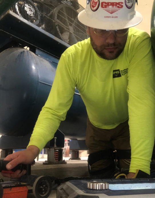
We also went to the floor below and above the floor being scanned to determine if the slabs were consistent on each floor. Once we were ready to scan, indicated the perimeter of the area being scanned using dash marks. We then set-up and calibrated our 1600MHz antenna and GSSI SIR-4000 unit at each of the four proposed areas and began scanning. During our scanning, we marked all findings on the surface using permanent marker or crayon per customer request. The image to the right depicts our Toledo/NW Ohio Project Manager, Justin Rasanow, scanning one of the four proposed locations requested by the contractor. The remaining two images depict on-site photos of areas that have been scanned with the anomalies and scanning boundary indicated on the surface. The markings with diagonal lines running through them indicate anomalies with characteristics of rebar. The wider markings with an “X” running through them indicate anomalies with characteristics of conduit.
Each location was scanned to a size of roughly 3’x3’, depending on the amount of surface area available in each area. The size of each scan was also based on giving the contractor enough space to have options of where to place his proposed cores based on our findings on the surface. It is important to call GPRS and have each area being cut scanned with GPR prior to any work being done. In this case, we were able to help the contractor avoid coring through different electrical conduits and crucial reinforcement steel within the slab. Upon the completion of our scanning and explanation of our markings to the site contact, the contractor was able to determine where they should place their cores. They felt confident that they could now core their holes without drilling through any anomalies in the slab.
Contact either Justin Rasanow 419-481-6737, Justin.rasanow@gprsinc.com or Andy Jurski 419-376-5021, andy.jurski@gprsinc.com for any of your concrete or utility scanning needs.
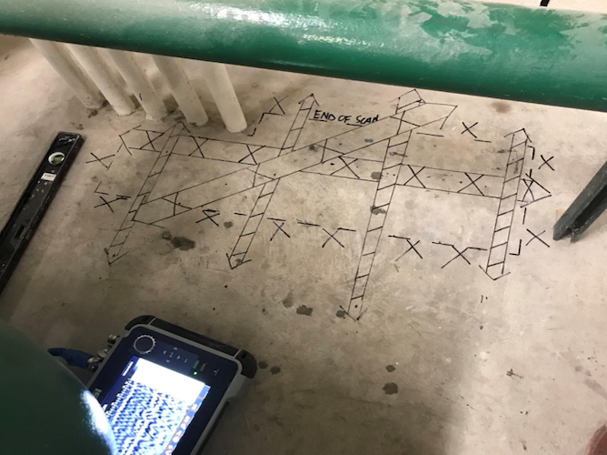
One of the 4 proposed areas scanned for this survey. Our surface markings indicate that anomalies with characteristics of both reinforcement steel and conduit were found within the area scanned. The scanning boundary is indicated on the surface using dash marks.
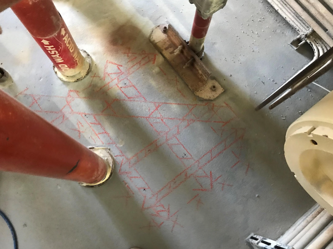
One of the 4 proposed areas scanned for this survey. Our surface markings indicate that anomalies with characteristics of both reinforcement steel and conduit were found within the area scanned. The scanning boundary is indicated on the surface using dash marks. This particular area was marked using crayon, per customer request.